Work with routing
Routing is a powerful feature in FH Mobile Response that provides a visual route (draws a line) between start and end points on a map, indicates turns with colored circles on the route line, and provides turn-by-turn directions. Depending on how you configure routing, you can even have audible voice alerts on your turn-by-turn directions.
Information on configuring routing is available in Configure routing to use information from a GPS device. Informaton on routing and voice attributes is available in Specify routing and voice attributes.
Note: Routing in FH Mobile Response is designed for mobile computers that are using a global positioning system (GPS) device and which are configured to communicate with FH Mobile Response to track your current location. While you can manually set start and destination points and have FH Mobile Response calculate a route between them, it is preferable to use a GPS device with FH Mobile Response. Information on configuring a GPS device with FH Mobile Response is available in Set up GPS communication with FH Mobile Response.
The Routing Maps tab consists of three parts:
|
|
|
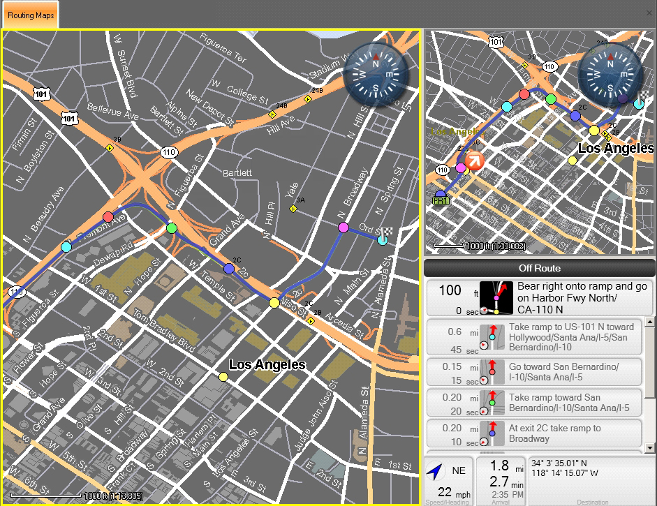
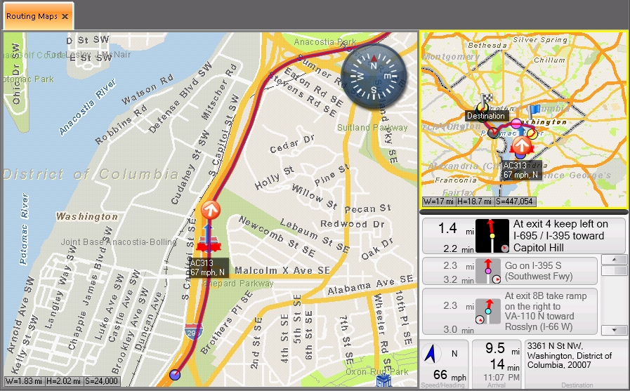
Note: On a wide-screen monitor these three parts are equally sized columns.
If you are using a GPS device, the pane in the lower right corner displays turn-by-turn directions.
|
|
|
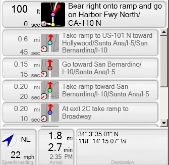
At the bottom of the turn-by-turn directions pane, the current heading, estimated speed, remaining miles to the destination, estimated the time of arrival, and the destination address appear.
Information on routing to and from different types of locations is available from:
- Route to a found location
- Route from a found location
- Route to an incident location
- Route to an occupancy
- Route from an occupancy
- Route to a hydrant
- Route from a hydrant
Configure routing to use information from a GPS device
Close or display the Routing Maps tab
Manually define a starting point for a route
Clear a starting point marker from the map
Manually define a destination point for a route
Clear a destination point marker from the map
View turn-by-turn directions without a GPS device