View an occupancy on a map
-
Choose Go → Open → Open Occupancy.
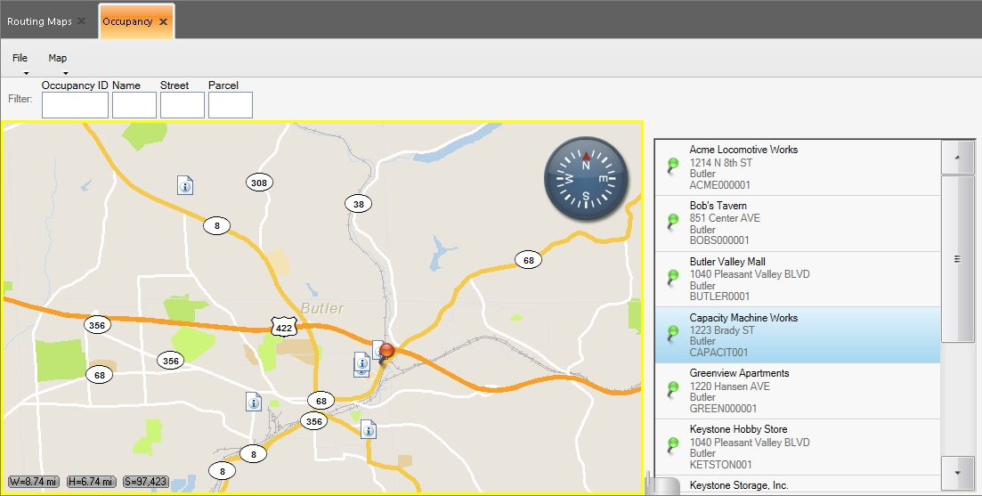
The Occupancy tab appears, displaying a map, a list of occupancies to the right of the map, and a push-pin indicating the location of the occupancy selected in the list. Two additional menus, File and Map, appear on the tab above the map, and the Occupancy ID, Name, Street, and Parcel filter fields appear above the map.
Note: If an item in the list of occupancies does not have a geocoded location (a latitude and longitude value), the occupancy is marked with a red X over its push-pin icon
 in the list, and the occupancy is not identified on the map.
 -
(Optional) In Occupancy ID, Name, Street, or Parcel, type text or numbers to shorten the list of occupancies to only the ones containing the information you enter.
Example: To quickly find an occupancy whose name begins with the letter S, in Name, type
S. The list of occupancies shortens to only those occupancies that begin with the letter S. -
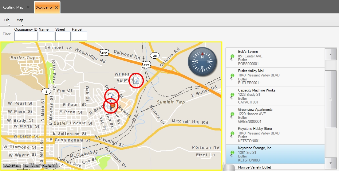
From the occupancy list, select the occupancy you want to view on the map.
The occupancy is identified with a red push-pin through an information icon
 , and the other occupancies are indicated as information icons
  .
. 
-
(Optional) Pan or zoom the map as needed to see the area around the occupancy, in any of these ways.
 Automatically zoom to the occupancy
-
On the Occupancy tab, choose Map → Zoom to Selected.
The zoom level on the map changes as needed to center the occupancy's location from 2000 feet (1:24,000), at the center of the map. This is the default display for the an occupancy when you select one from the occupancy list to the right of the map.
Automatically zoom see all the occupancies
-
On the Occupancy tab, choose Map → Zoom to All.
The zoom level on the map changes as needed to display the locations of all the occupancies on the map. The selected occupancy is identified with a red push-pin through an information icon
, and the other occupancies are indicated as information icons .
Automatically pan to the occupancy
-
On the Occupancy tab, choose Map → Pan to Selected.
The view of the map shifts (pans) as needed at the current zoom level to display the selected occupancy.
Manually pan or zoom
-
Information on manually panning and zooming is available in Pan, zoom in, and zoom out on the map.
-