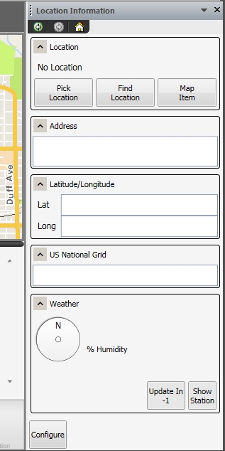
View location information
You can view the information about any location on map, such as its street address, latitude and longitude, US National Grid number, and the weather at that location. Weather information is drawn from the closest National Oceanic and Atmospheric Administration (NOAA) or automatic weather station (AWS), and the station's location also appears on the map.
-
Do one of the following.
- Choose Go → Tools → Map Commands → Location Information.
- (Premium) On the Main ribbon, click Location Information.
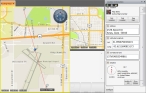
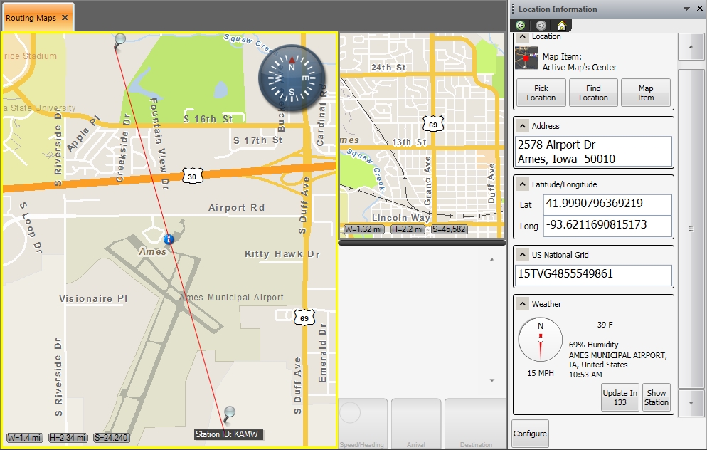
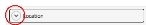
The Location Information pane appears on the right side of the interface.
-
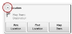
Under Location, determine the location you want information for in one of these ways.
 Pick a location on the map
-
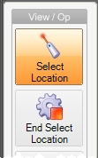
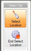
Click Pick Location.
The mouse pointer becomes a cross-hair, and in the View / Op toolbar on the left side of the interface, the Select Location and End Select Location icons appear. By default, Select Location is selected.
-
Click the map at the location you want to view information about.
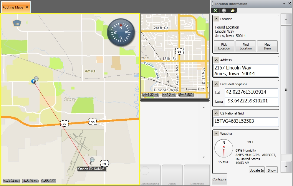
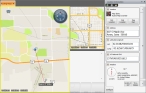
The Location Information pane populates with data about the location you clicked on the map, an information icon with a push-pin through it appears at the location you clicked, and a red line appears from the location to the weather station that weather information was gathered from.
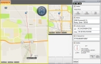
Tip: To see the location of the weather station relative to the picked location, at the bottom of the Location Information pane, under Weather, click Show Station. Your view of the map zooms out until the location of the weather station at the other end of the red line is visible.
-
In the View / Op toolbar, click End Select Location.
Select Location and End Select Location disappear from the toolbar.
Search for a location
-
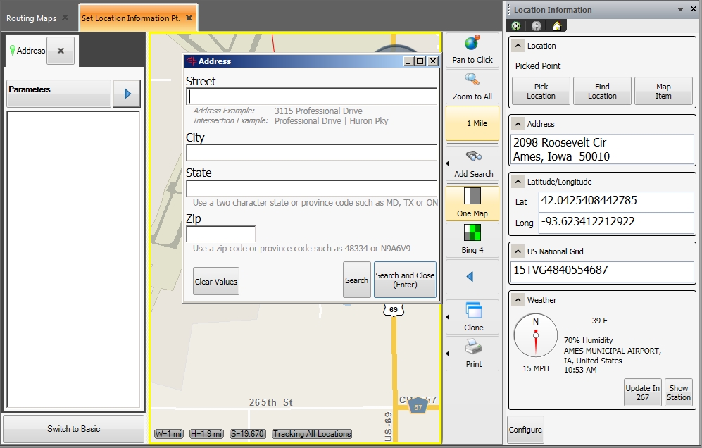
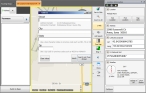
Click Find Location.
The Set Location Information Pt. tab and the Address dialog box appear.
-
Use the fields in the dialog box to find a location by its address or intersection of two streets.
Information on these searches is available in Find a location using its address and Find the intersection of two streets.
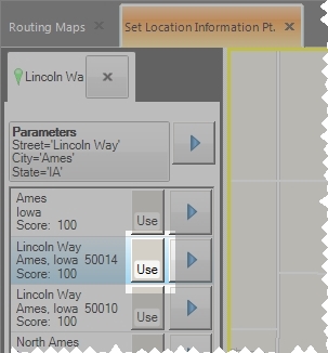
The Set Location Information Pt. pane updates, listing the possible results for your search, and corresponding location icons appear on the map.
Example: If you searched for a point-of-interest (POI) such as all the gas stations within the viewable area on the map, you may have several choices listed in Location Results and several push-pins on the map.
- In the Set Location Information Pt. pane, select the location you want information about.
-
To the right of the selected location, click Use.

The Set Location Information Pt. pane closes, the information for the selected location appears in the Location Information pane, an information icon with a push-pin through it appears at the location you clicked, and a red line appears from the location to the weather station that weather information was gathered from.

Tip: To see the location of the weather station relative to the picked location, at the bottom of the Location Information pane, under Weather, click Show Station. Your view of the map zooms out until the location of the weather station at the other end of the red line is visible.
Select an item on the map
-
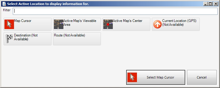
Click Map Item.
The Select Active Location to display information for dialog box appears.
Note: The buttons in this dialog box vary, depending on the map items displayed on the selected map.
-
Click the map item that corresponds to the location you want to view information for.
Example: To view location information for the destination, click Active Map's Center.
The dialog box closes, the information for the selected location appears in the Location Information pane, an information icon with a push-pin through it appears at the location you clicked, and a red line appears from the location to the weather station that weather information was gathered from.
Tip: To see the location of the weather station relative to the picked location, at the bottom of the Location Information pane, under Weather, click Show Station. Your view of the map zooms out until the location of the weather station at the other end of the red line is visible.
-
-
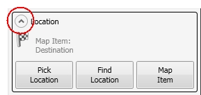
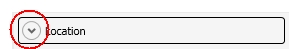
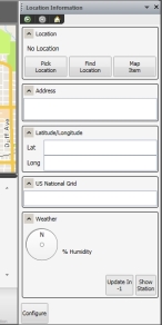
(Optional) Click the expand/contract arrow in each section of the Location Information pane to view or hide portions of the pane.
-
(Optional) Under Weather, click Update In to force an immediate update of the weather information displayed.
-
(Optional, if the location of the weather station is not visible on the map) Under Weather, click Show Station.
Your view of the map zooms out until the location of the weather station at the other end of the red line is visible.