Select a map view
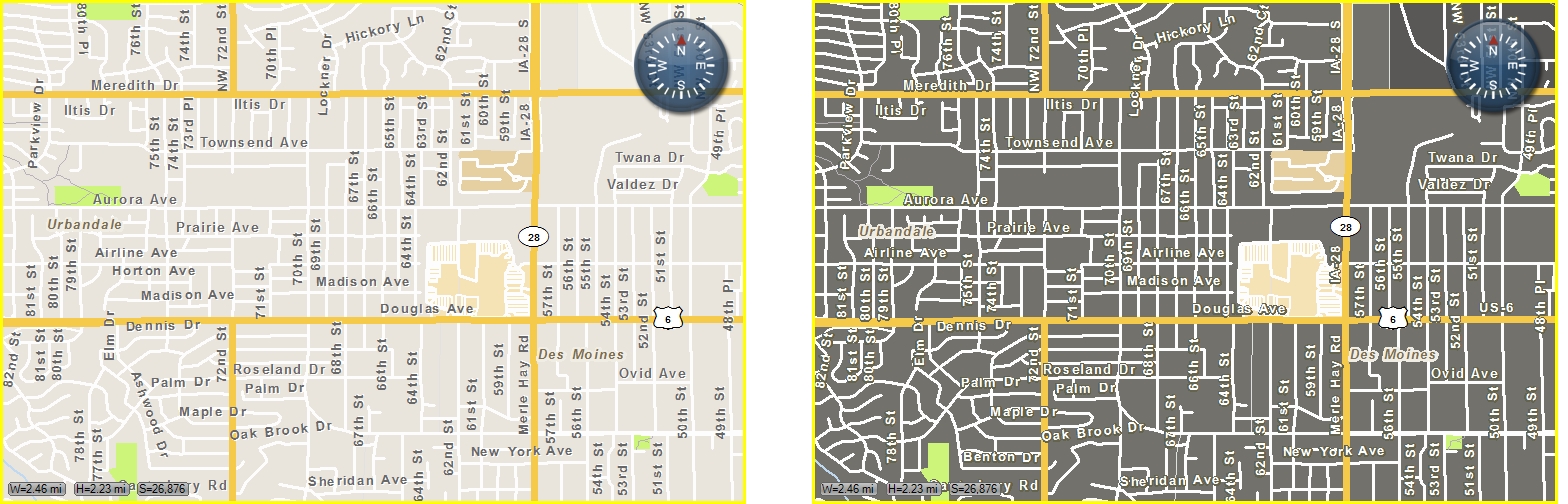
A map view is a way to display a geographic information system (GIS) map with various layers you can display or hide. You can also view the same map in either day view or night view. These modes let you change the map colors to be more readable in sunlight or in darkness.
- Click the tab of the map you want the map view to appear in.
-
Do one of the following.
- Choose Go → Tools → Map Commands → Set View.
- On the Main toolbar, click Set View.
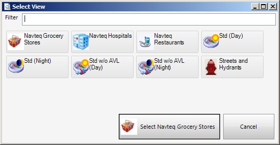
The Select Views dialog box appears.
Your region's GIS managers can provide customizations to these views, as a typical FH Mobile Response deployment includes both the included Navteq data and local data layers for fire hydrants and aerial data. When these additional data layers are available, you can create views to combine various layers to address specific response modes.
Note: You must have purchased FH Mobile Response Premium to add map views of information layers in FH Mobile Response. For information on upgrading from FH Mobile Response Basic to Premium, contact your FH sales representative.
Information on creating map views is available in Add a map view.
-
Click the name of the map view you want to display in the selected map.
The dialog box closes, and the view of the map you selected appears in the currently selected map.