Use aerial views of maps
You can view photographic aerial or street-level imagery in FH Mobile Response, using pre-configured views that display layouts of Google Street View or Bing Maps aerial imagery.
Note: Because these images are pulled from the internet, you must have a mobile wireless connection for client computers to use this feature.
Note: You must have purchased FH Mobile Response Premium to view aerial images in FH Mobile Response. For information on upgrading from FH Mobile Response Basic to Premium, contact your FH sales representative.
You can also view Pictometry aerial imagery, and take advantage of Pictometry's measurement tools. Pictometry is a third-party application embedded into FH Mobile Response. It is similar to Bing Bird's Eye imagery, in that the photographs it displays are taken at a 45-degree angle, oriented in four directions. Pictometry adds measurement tools to help you analyze a location.
Information on Pictometry is available at http://www.eagleview.com/Products/ImageSolutionsAnalytics/PictometryImagery.aspx.
Note: Pictometry is licensed data which must be stored locally, or accessed over a network. Pictometry must be properly configured with a license file and warehouse file to work in FH Mobile Response.
Information on configuring Pictometry is available in Change map and data file locations.
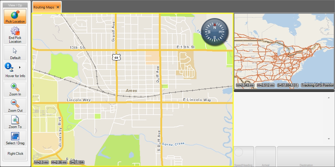
- Select the map you want to base the aerial view on.
-
Display an aerial view of one of the following locations.
 The map's center
Display a Google "straight-down" view.
The map's center
Display a Google "straight-down" view.
-
Do one of the following.
- Choose Go → Map → Aerial Views → Google Aerial North Orientation → Open Window.
- On the Main toolbar, choose Google Aerial North Orientation → Open Window.
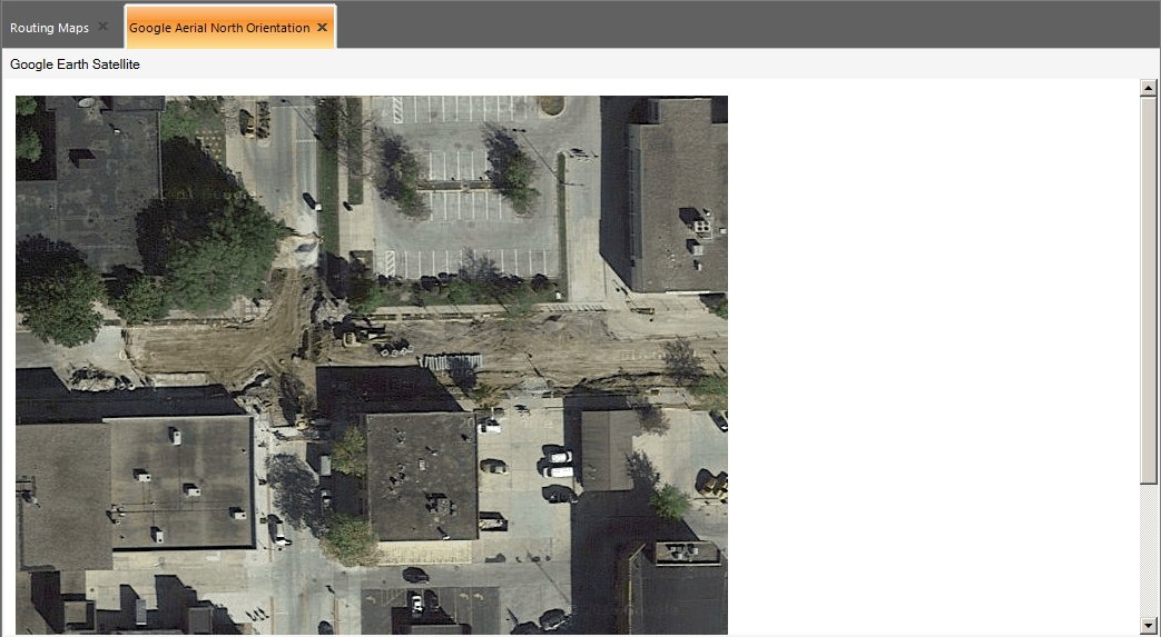
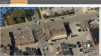
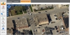
The Google Aerial North Orientation tab appears, displaying a single, static, straight-down satellite image based on the map's screen center.
Note: There are no zoom or pan controls within this window—to view an adjacent image, you must open a new window. The advantage of Google imagery is that it is updated more regularly than Bing images.
Display a Bing "straight-down" view.
-
Do one of the following.
- Choose Go → Map → Aerial Views → Bing Aerial North Orientation → Open Window.
- On the Main toolbar, choose Bing Aerial North Orientation → Open Window.
The Bing Aerial North Orientation tab appears, displaying a single, static, straight-down satellite image based on the map's screen center.
Note: You can use the controls inside Bing's browser window to switch to another vantage point, display street labels, or even switch between image types.
Display a Bing "bird's eye" north-facing view.
-
Do one of the following.
- Choose Go → Map → Aerial Views → Bing "Bird's eye" View Large → Open Window.
- On the Main toolbar, choose Bing "Bird's eye" View Large → Open Window.
The Bing "Bird's eye" View Large tab appears, displaying a north-facing, high-resolution image taken at a 45 degree angle, offering a vantage point above and to the side of the map's screen center.
Note: You can use the controls inside Bing's browser window to switch to another vantage point, display street labels, or even switch between image types.
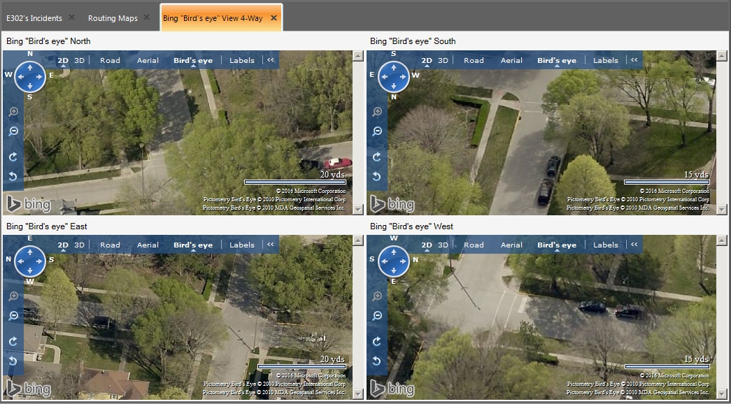
Display four Bing "bird's-eye" views.
-
Do one of the following.
- Choose Go → Map → Aerial Views → Bing "Bird's eye" View 4-Way → Open Window.
- On the Main toolbar, choose Bing "Bird's eye" View 4-Way → Open Window.
The Bing "Bird's eye" View 4-Way tab appears, displaying four high-resolution images from north, south, east and west, taken at a 45 degree angle, and offering a vantage point above and to the side of the map's screen center.
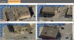
Note: You can use the controls inside Bing's browser window to switch to another vantage point, display street labels, or even switch between image types. You can control each of the four views separately.
A selected location on the map
Display a Google "straight-down" view.
-
Do one of the following.
- Choose Go → Map → Aerial Views → Google Aerial North Orientation → Select Location.
- On the Main toolbar, choose Google Aerial North Orientation → Select Location.
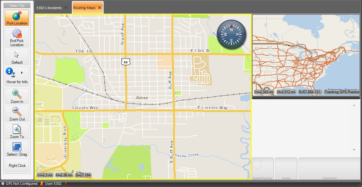
In the View / Op toolbar, the Pick Location and End Pick Location icons appear, and the mouse pointer changes to a cross-hair.

-
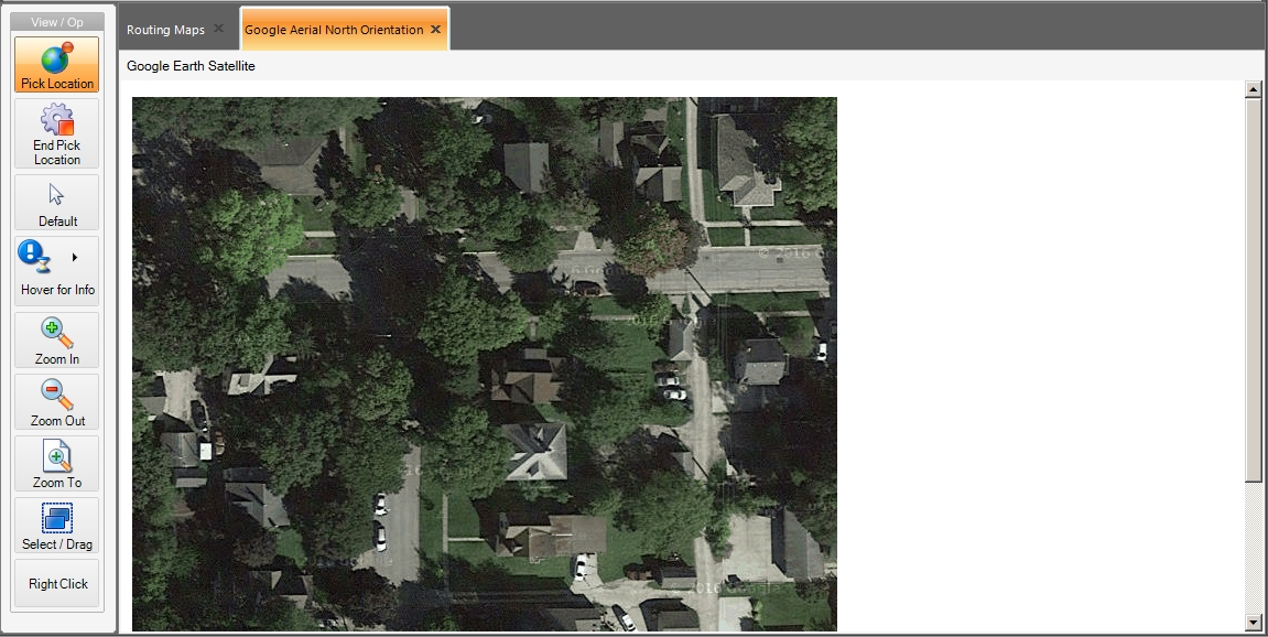
In the map, click the point you want to see a satellite view for.
The Google Aerial North Orientation tab appears, displaying a single, static, straight-down satellite image centered on the point you clicked.
The advantage of Google imagery is that it is updated more regularly than Bing images.
Note:
- There are no zoom or pan controls within this window.
- The Pick Location and End Pick Location icons still appear in the View / Op toolbar, and are still active,
-
(Optional) Click the tab of the map you want to pick a new point in, then click the point.
The aerial view displayed in the Google Aerial North Orientation tab updates to reflect the new location you picked. You can repeat the previous two steps as many times as needed.
- In the View / Op toolbar, click End Pick Location to end the point selection mode.
Display a Bing "straight-down" view.
-
Do one of the following.
- Choose Go → Map → Aerial Views → Bing Aerial North Orientation → Select Location.
- On the Main toolbar, choose Bing Aerial North Orientation → Select Location.
In the View / Op toolbar, the Pick Location and End Pick Location icons appear, and the mouse pointer changes to a cross-hair.

-
In the map, click the point you want to see a satellite view for.
The Bing Aerial North Orientation tab appears, displaying a single, static, straight-down satellite image based on the map's screen center.
Note:
- You can use the controls inside Bing's browser window to switch to another vantage point, display street labels, or even switch between image types.
- The Pick Location and End Pick Location icons still appear in the View / Op toolbar, and are still active,
-
(Optional) Click the tab of the map you want to pick a new point in, then click the point.
The aerial view displayed in the Bing Aerial North Orientation tab updates to reflect the new location you picked. You can repeat the previous two steps as many times as needed.
- In the View / Op toolbar, click End Pick Location to end the point selection mode.
Display a Bing "bird's eye" north-facing view.
-
Do one of the following.
- Choose Go → Map → Aerial Views → Bing "Bird's eye" View Large → Select Location.
- On the Main toolbar, choose Bing "Bird's eye" View Large → Select Location.
In the View / Op toolbar, the Pick Location and End Pick Location icons appear, and the mouse pointer changes to a cross-hair.
-
In the map, click the point you want to see a satellite view for.
The Bing "Bird's eye" View Large tab appears, displaying a north-facing, high-resolution image taken at a 45 degree angle, offering a vantage point above and to the side of the map's screen center.
Note:
- You can use the controls inside Bing's browser window to switch to another vantage point, display street labels, or even switch between image types.
- The Pick Location and End Pick Location icons still appear in the View / Op toolbar, and are still active,
-
(Optional) Click the tab of the map you want to pick a new point in, then click the point.
The aerial view displayed in the Bing "Bird's eye" View Large tab updates to reflect the new location you picked. You can repeat the previous two steps as many times as needed.
- In the View / Op toolbar, click End Pick Location to end the point selection mode.
Display four Bing "bird's eye" views.
-
Do one of the following.
- Choose Go → Map → Aerial Views → Bing "Bird's eye" View 4-Way → Select Location.
- On the Main toolbar, choose Bing "Bird's eye" View 4-Way → Select Location.
In the View / Op toolbar, the Pick Location and End Pick Location icons appear, and the mouse pointer changes to a cross-hair.
-
In the map, click the point you want to see a satellite view for.
The Bing "Bird's eye" View 4-Way tab appears, displaying four high-resolution images from north, south, east and west, taken at a 45 degree angle, and offering a vantage point above and to the side of the map's screen center.

Note:
- You can use the controls inside Bing's browser window to switch to another vantage point, display street labels, or even switch between image types.
- The Pick Location and End Pick Location icons still appear in the View / Op toolbar, and are still active,
-
(Optional) Click the tab of the map you want to pick a new point in, then click the point.
The aerial view displayed in the Bing "Bird's eye" View 4-Way tab updates to reflect the new location you picked. You can repeat the previous two steps as many times as needed.
- In the View / Op toolbar, click End Pick Location to end the point selection mode.
-
-
(If you have a Pictometry license) Use the features in these following two menus.
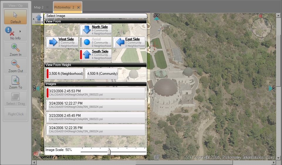
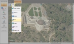
Select Image menu
 Change perspective
Under View From, you can change the perspective when observing a Pictometry window. You can have multiple perspectives of the same area open at once by adding new Pictometry windows and changing the orientation of the individual windows. By placing the perspectives in different panes, you can effectively look at all sides of an area at once, on the same screen.
Choose distance to view from
Under View From Height, you can choose which resolution to view the perspectives with.
- Community presents a wider, zoomed-out view.
- Neighborhood presents a close-up inspection of a location.
View images of a target point
Pictometry images are a mosaic of overlapping images, presented as seamlessly as possible.
Under Images, image files containing your targeted selection point appear. You can view information about the current image, or select an adjacent image for viewing.
Tools menu
 Determine the horizontal distance
- Choose Tools → Distance.
-
Click, then drag a line across an area within a Pictometry window.
A line appears from the point where you clicked. The actual horizontal distance represented by that line appears in the lower left corner of the window.
Determine the perimeter of a box
- Choose Tools → Distance.
-
Hold down the
Ctrlkey, click, then drag across an area within a Pictometry window.A box appears from the point where you clicked. The perimeter distance represented by that box appears in the lower left corner of the window.
Determine the compass bearing of a line
- Choose Tools → Bearing.
-
Click, then drag a line across an area within a Pictometry window.
A box appears from the point where you clicked. The compass bearing of the line, as expressed from -180 to 180 degrees, appears in the lower left corner of the window.
Determine the square footage of an area
- Choose Tools → Area.
-
Click, then drag a line across an area within a Pictometry window.
-
Hold down the
Ctrlkey on the keyboard and drag the mouse pointer at an angle away from your line.A polygon appears, and the actual square footage inside the polygon appears in the lower left corner of the window.
Note: Hold down the
Altkey instead of theCtrlkey to freehand-draw an area.
Determine vertical distance (height)
- Choose Tools → Height.
-
Click, then drag a line across an area within a Pictometry window.
A line appears from the point where you clicked. The actual vertical distance represented by that line appears in the lower left corner of the window.
Determine the elevation
- Choose Tools → Elevation.
-
Click on a point within a Pictometry window.
The actual distance above sea level at that point appears in the lower left corner of the window.
Note: If you click, then drag a line across an area within a Pictometry window, the difference in elevation between the first and second location appears in the lower left corner of the window.
Determine the "trip distance" along several points on one or more Pictometry zones
- Choose Tools → Walking Man.
- Click on a point within a Pictometry window to establish a starting location.
-
Click to mark a destination from the currently selected point in the window.
The distance between the two points appears in the lower left corner of the window.
-
Continue to click points to add destinations.
Note: Click off the edge of the screen to continue the trip into an adjacent Pictometry area.
The overall distance of the trip appears in the lower left corner of the window, and updates with each additional destination added.