Find a location using the US National Grid
The United States National Grid (USNG) is a point reference system of grid references commonly used in the United States.
- Select the tab of the map that you want the location to appear in when you find it.
-
Do one of the following.
- On the Main ribbon, click Find Locations → Latitude Longitude.
- Choose Go → Tools → Find Locations → Latitude Longitude.
- Choose Go → Tools → Routing → Find Locations → Latitude Longitude.
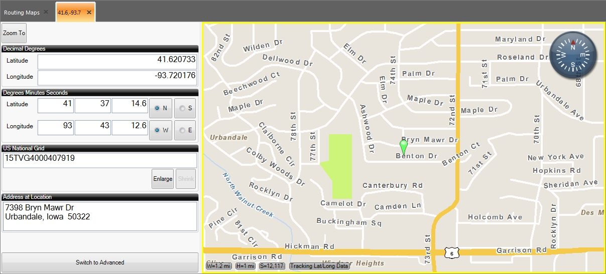
A tab named with a pair of numerical values appears to the left of the map, and contains fields for specifying latitude, longitude, and United States National Grid (USNG) values. The map you selected initially displays a location icon at a random location.

-
Under US National Grid, enter the USNG spatial address.
-
In the tab, click Zoom To.
A location icon appears in the map you had selected, at the location of the USNG spatial address you specified.

If an address is available for the latitude and longitude values, it appears in the tab under Address at Location.
-
 (Optional) View more information for the location.
-
At the bottom of the tab, click Switch to Advanced to view more information for the location.
The Locations tab appears, the tab displaying the location information becomes a sub-tab of the Locations tab, the button at the bottom of the tab is renamed to Switch to Basic, and to the right of the map, a toolbar of additional options appears.

Information on using the toolbar on the right to control the map the location results appear in is available in Work with advanced map controls.
-
(Optional) At the bottom of the tab, click Switch to Basic to display the basic version of the possible match list.
The Locations tab disappears, the button at the bottom of the tab is renamed to Switch to Advanced, and to the right of the map, the toolbar of additional options disappears.
-